The fifth largest US state, New Mexico, or New Mexico, is located in the southwest of the United States. It also has the nickname “Land of Enchantment”, from Spanish “Tierra de Encanto”.
New Mexico is bordered by Colorado to the north, Oklahoma to the northeast, Texas to the east and south, and Arizona to the west. New Mexico borders Utah in the northwest at the so-called Four Corners.
The state border with Mexico also forms part of the southern border of New Mexico. The territory formerly part of Mexico was annexed by the victors, the United States of America, as part of the American-Mexican War in 1846-48.
The US state of New Mexico
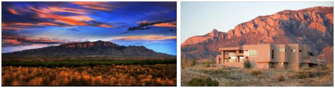
Manzano Mountains near Albuquerque, New Mexico
About 76,000 people live in the capital Santa Fe, New Mexico covers a total area of almost 315,000 km².
This corresponds almost exactly to the area of Poland. The residents of the mainly plateau area are 45% White, 42% Latino or Hispanic descent, 9% Native American and the rest divided into other races.
The white man will also soon be overtaken, because the Hispanic population is constantly growing, while the white male produces fewer offspring.
El Camino Real de Los Tejas National Historic Trail
The El Camino Real de los Tejas National Historic Trail runs through the US states of Texas, New Mexico and Louisiana, which is more than 300 years old, making it the oldest road in Texas. It is formed by Highway 6 in Louisiana and Highway 21 in Texas. The name of the road could be translated from Spanish as the King’s Road, and in the past it was also used by native Indian tribes. Subsequently, from 1691, by Spanish and French missionaries of various faiths.
Around 1835, numerous Mexican and American troops, American and German settlers and well-known personalities of the time, such as Kit Carson, Davy Crocket, Jim Bowie, Sam Houston, Santa Anna, Lyndon Johnson and many others passed through here.
Originally the trail ran only through the territory of Texas, but the Spanish expanded it and connected it to the trail in Louisiana and Mexico. In total, the trail is around 700 miles and runs from Monterey, Mexico to Robline, Louisiana. It thus connects not only geographically but also politically different areas. A large part of this trail has survived to this day. It crosses the most spectacular natural scenery of both states and leads through remote rural areas.
On the way, you can come across the ancient Spanish mission in San Antonio and a number of other historic towns – Bastrop, Crockett, Alto, Nacogdoches or San Augustine. The road also passes by pine forests, beautiful rivers, such as in New Braunfels, San Marcos and La Grange.
Climate and weather conditions
Due to its location in the southern United States, the climate in New Mexico is quite dry and hot in summer. The wind often comes up only sparsely, since large parts are on the windward side of the Rocky Mountains. Only in the outer west does it get really wet in summer, because here the cloud masses rain down on the Rockys, which is why the forest cover is quite high there. Due to the location at mostly more than 2000 meters, it often gets quite cool at night. Even in winter it is quite cool and freezing in most parts of New Mexico. In the north of Santa Fe it is even so wintry that a winter sports center with “good skiing and tobogganing” has been built here.
Best time to travel to New Mexico
The best travel time for us tourists, who prefer to hike and explore nature by rental car or camper, is in the short transition period in spring and autumn.
The biggest cities
New Mexico’s largest cities with the population from the year 2010, rounded:
- Albuquerque 546,000
- Las Cruces 98,000
- Rio Rancho 89,000
- Santa Fe 76,000
- Roswell 47,000