Colombia is dominated by the Andes which form a highland in the west. Lowland east, partly belonging to the Orinoco Plain Llanos and partly to the Amazon ‘urskog Selva, occupying 3 / 5 of the land area, but is very sparsely populated. The western highlands consist of four distinct mountain ranges or cordilleras that run from southwest to northeast, almost parallel to each other. At the far west is the coastal mountain range Serranía de Baudó, which geologically belongs to Central America. The altitude is in most places less than 1000 meters above sea level, but the mountains are severely rugged and deep cut.
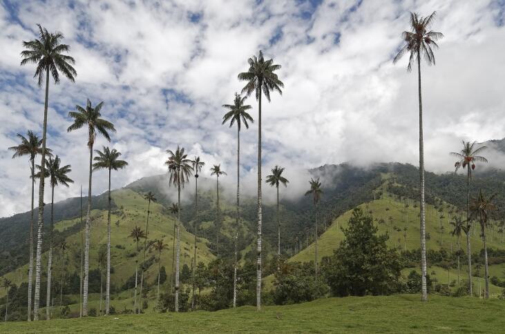
The Cocora Valley is located in the Andes Mountains Cordillera Central and is especially known for the widespread growth of the wax palm Ceroxylon quindiuense, Colombia’s national tree.
The Andes itself consists of three main chains:
- Cordillera Occidental, ‘the western mountain range’
- Cordillera Central, ‘the central mountain range’
- Cordillera Oriental, ‘the eastern mountain range’
The area has volcanic activity and earthquakes.
Cordillera Occidental is mainly made up of massive crystalline rocks and volcanoes. Farthest south are a number of high volcanoes, including the stratovolcano Cumbal, 4764 meters above sea level. East of the Cordillera Occidental lies the deep Cauca Valley (900-100 meters above sea level), where the river of the same name flows north and joins the Magdalena River.
Cordillera Central is the highest and has several peaks over 5000 meters above sea level, including Nevado del Huila (5750 meters above sea level), Nevado del Ruiz (5321 meters above sea level), and Nevado del Tolima (5280 meters above sea level). The chain is mainly made up of crystalline shales and young volcanic rocks ; the highest peaks are all young volcanoes.
The Cordillera Oriental forms the watershed between the Magdalena River and its river valley (300-500 meters above sea level) in the west and the Amazon in the east. This eastern chain is lower than the central chain, but wider as it dissolves in a plethora of branches that surround valleys and high plains. Most famous is Bogotás highland, which is about 2600 meters above sea level.
A little north of Bogotá there is the highest section, up to 5600 meters above sea level, but then the mountains descend through the Sierra de Perijá towards the Guajira Peninsula. To the west of this peninsula, the Sierra Nevada de Santa Marta forms an isolated mountain massif, with Pico Cristóbal Colón (5775 meters above sea level), the highest mountain in the country.
The Magdalena River is Colombia’s longest river (1560 km), and the most important navigable waterway. Cauca is the most important tributary of the Magdalena. From the Cordillera Oriental, a multitude of rivers descend on the lowland plains, where they are occupied by the Orinocos and the Amazon bees. In the north lies a wide lowland with the Magdalena delta, while the coastal land towards the Pacific is narrower.